Property Risk Section
Property Risk
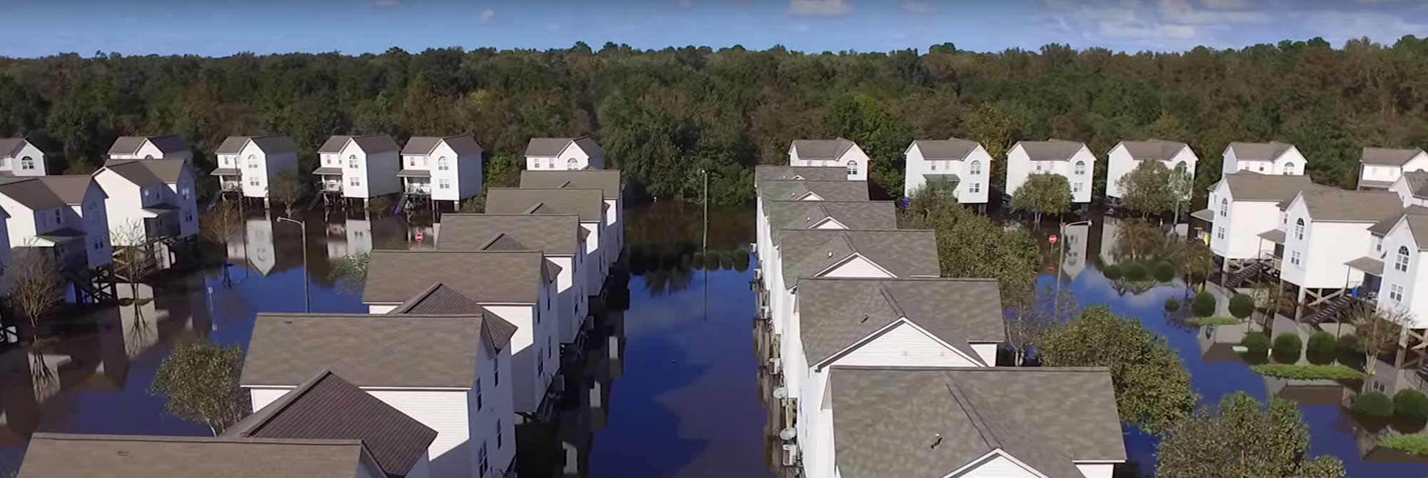
Learn about flood risk at a specific address, to include flood hazard, structural and content impacts, potential insurance rates, mitigation opportunities and the location of flood warning sites near you.
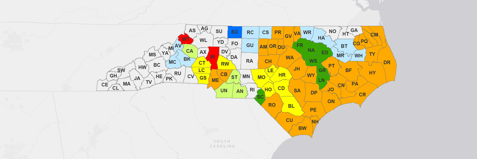
County Status
This map shows the current status of all active flood insurance studies throughout the state. Counties shows here are in the various stages of mapping including discovery, engineering analysis, floodplain mapping, preliminary and effective. Click a county on the map to view the status information.

Flood Risk Data is being updated across North Carolina
Learn about outreach opportunities for changes in your county
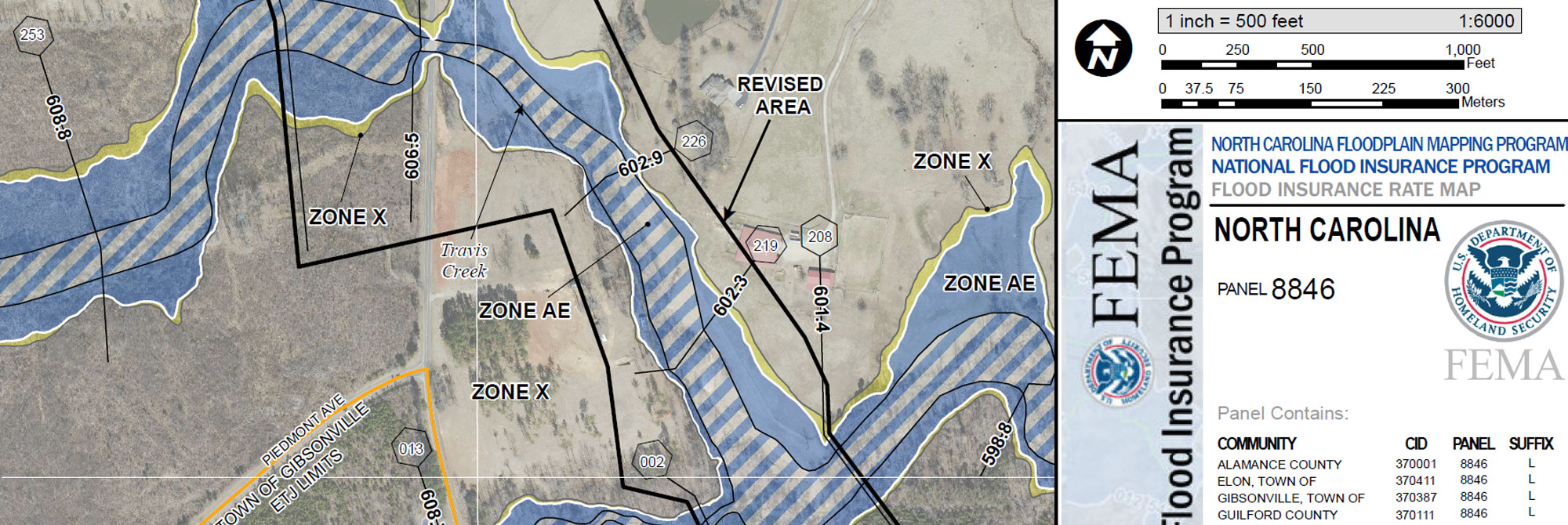
Letters of Map Change
MT-2 Letters of Map Change (LOMC) include Letters of Map Revision (LOMR) and Conditional Letters of Map Revision (CLOMR). These documents officially or conditionally revise a portion of the effective NFIP map according to requirements and procedures outlined in Part 65 of the NFIP regulations. For information about the MT-2 LOMC application process in North Carolina or to access issued documents, please click Learn More.
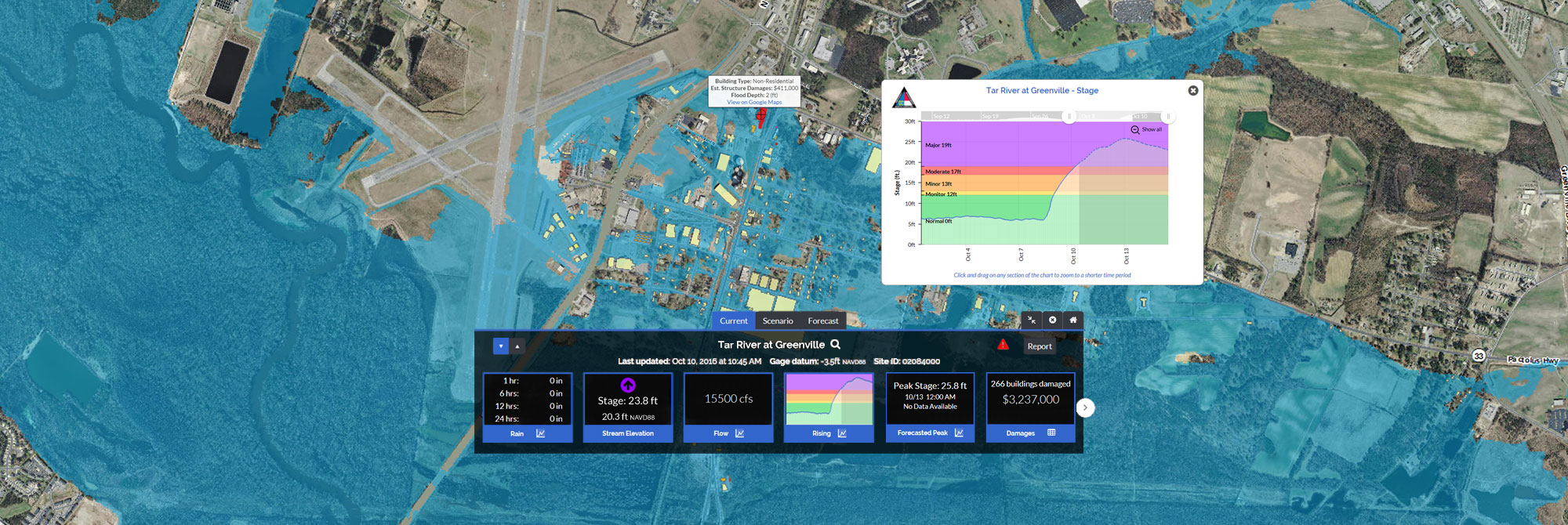
The North Carolina Flood Inundation Mapping and Alert Network
Providing rain and stage gauge data, flood inundation maps, flooding impacts and alerts in real-time to support risk-based decisions regarding flooding.
>Learn More >Learn More


